This map was printed by lithographers Adam Beck and Clemens J. Pauli in Milwaukee, Wisconsin and published by J. J. Stoner of Madison, Wisconsin. It looks northeast and includes an index to points of interest.
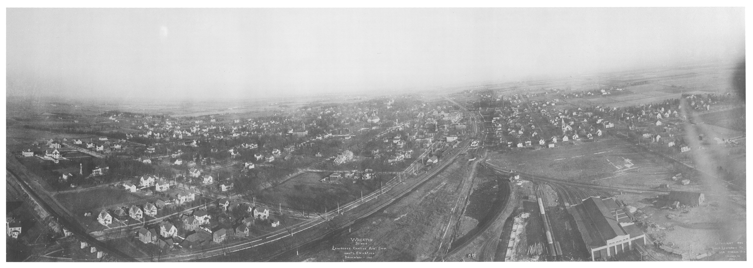
Photographer George R. Lawrence (1869-1938) captured this panoramic view of Wheaton in 1906 with a system he designed called the Captive Airship. Large-format cameras were suspended from unmanned kites and flown in connected lines which kept the cameras steady against varying wind conditions. The photo was taken from a vantage point approximately in the location of today’s Wheaton Center towers looking east in December 1906.
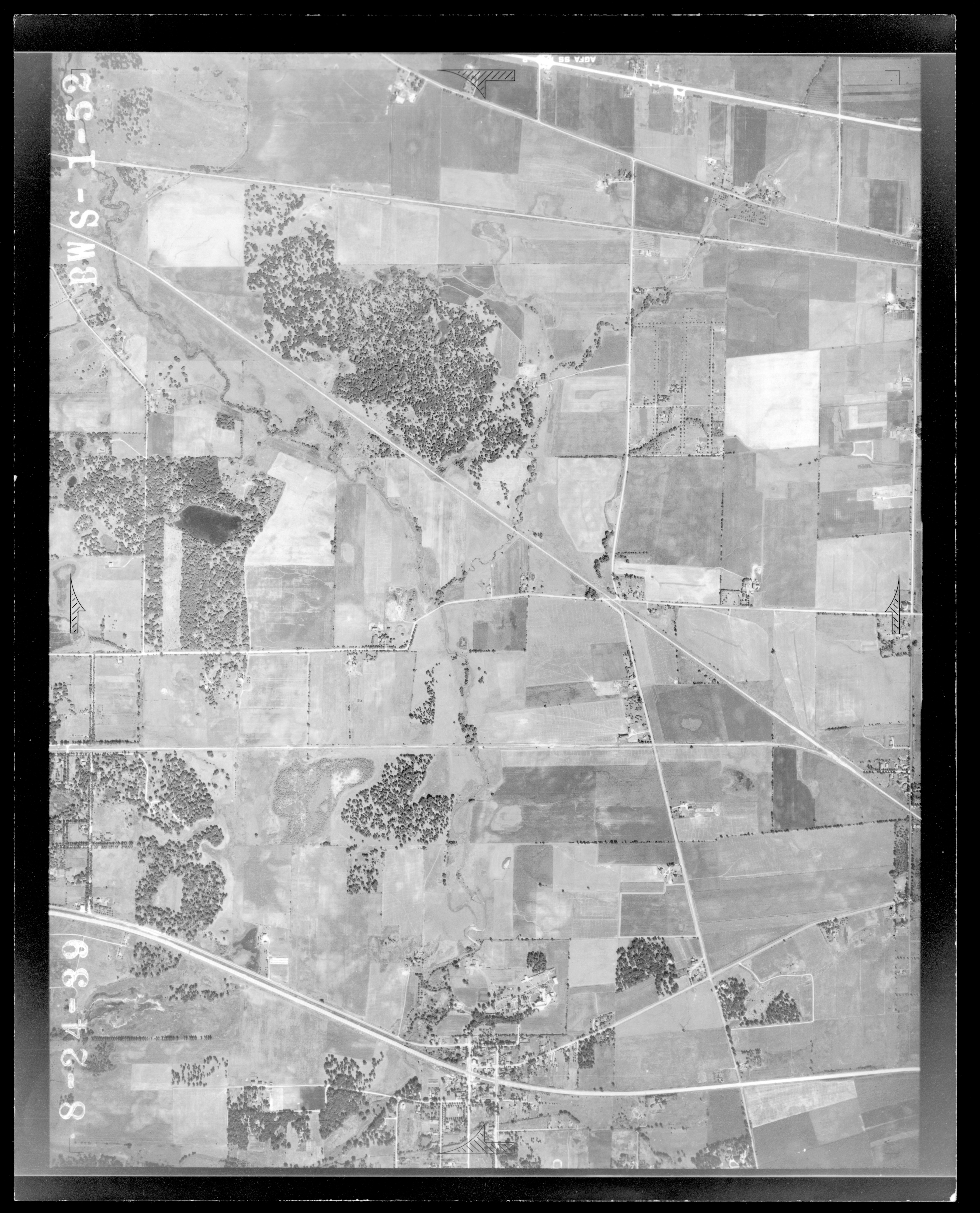
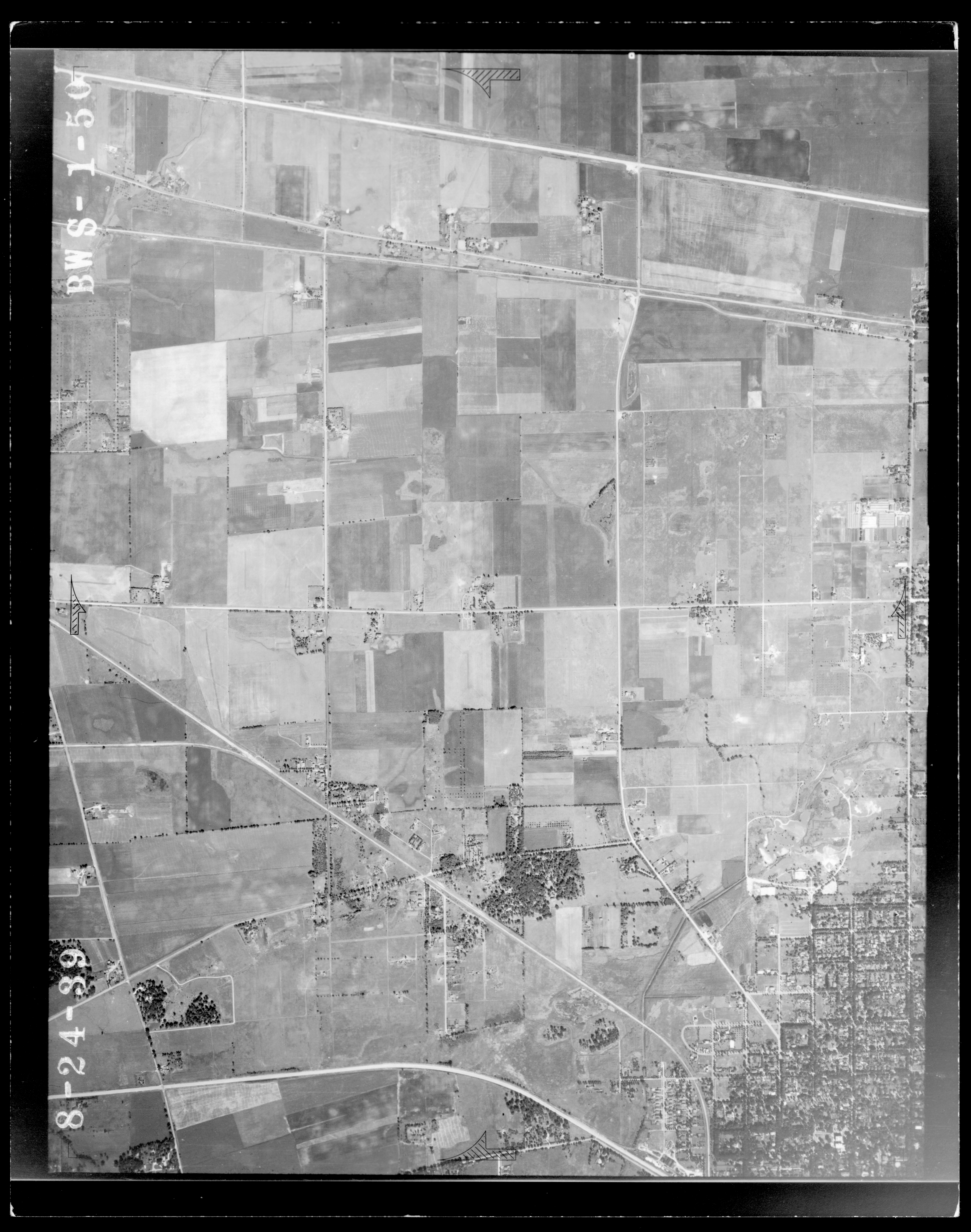
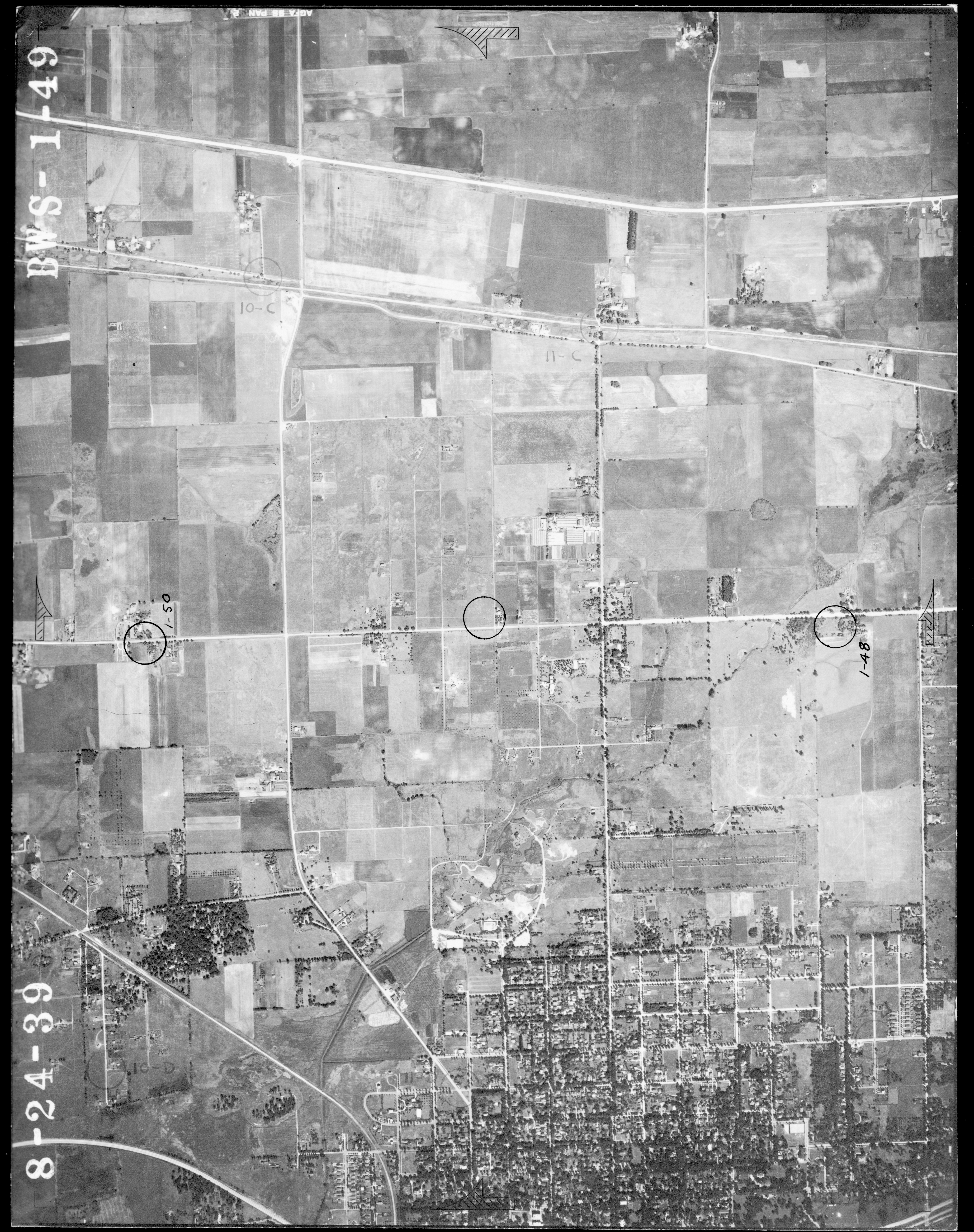
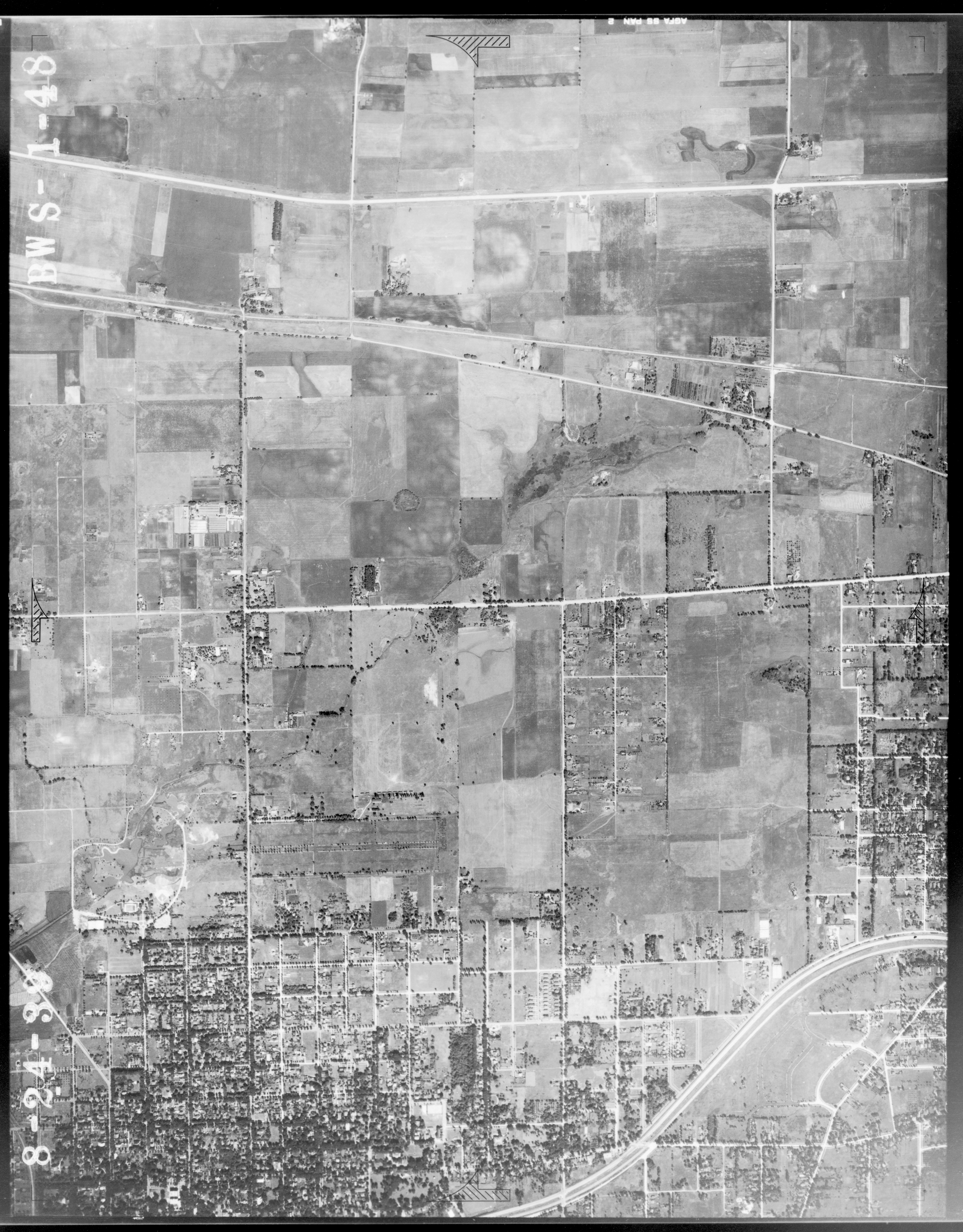
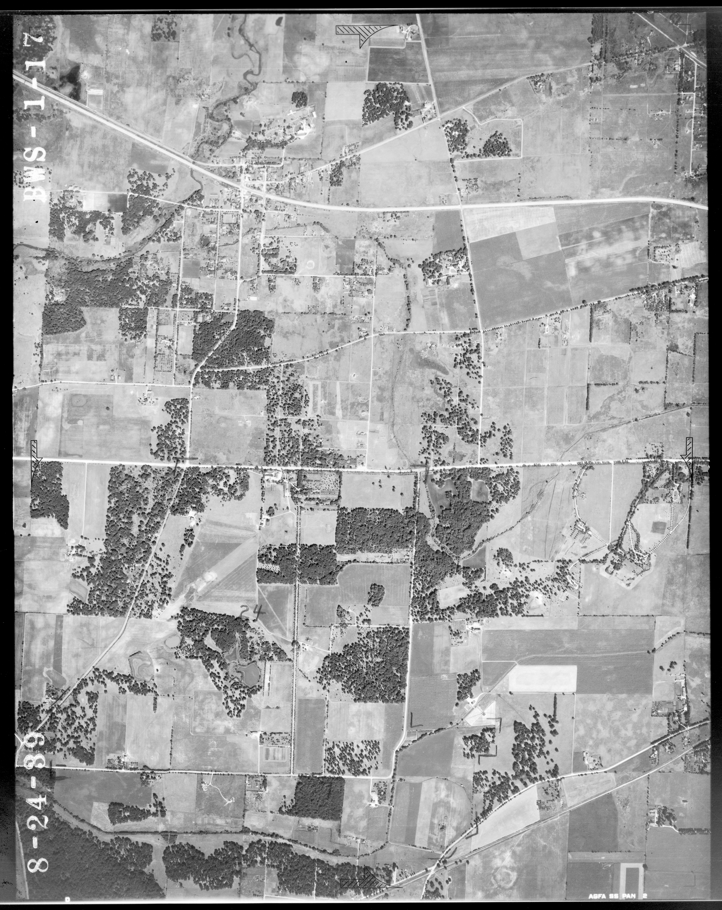
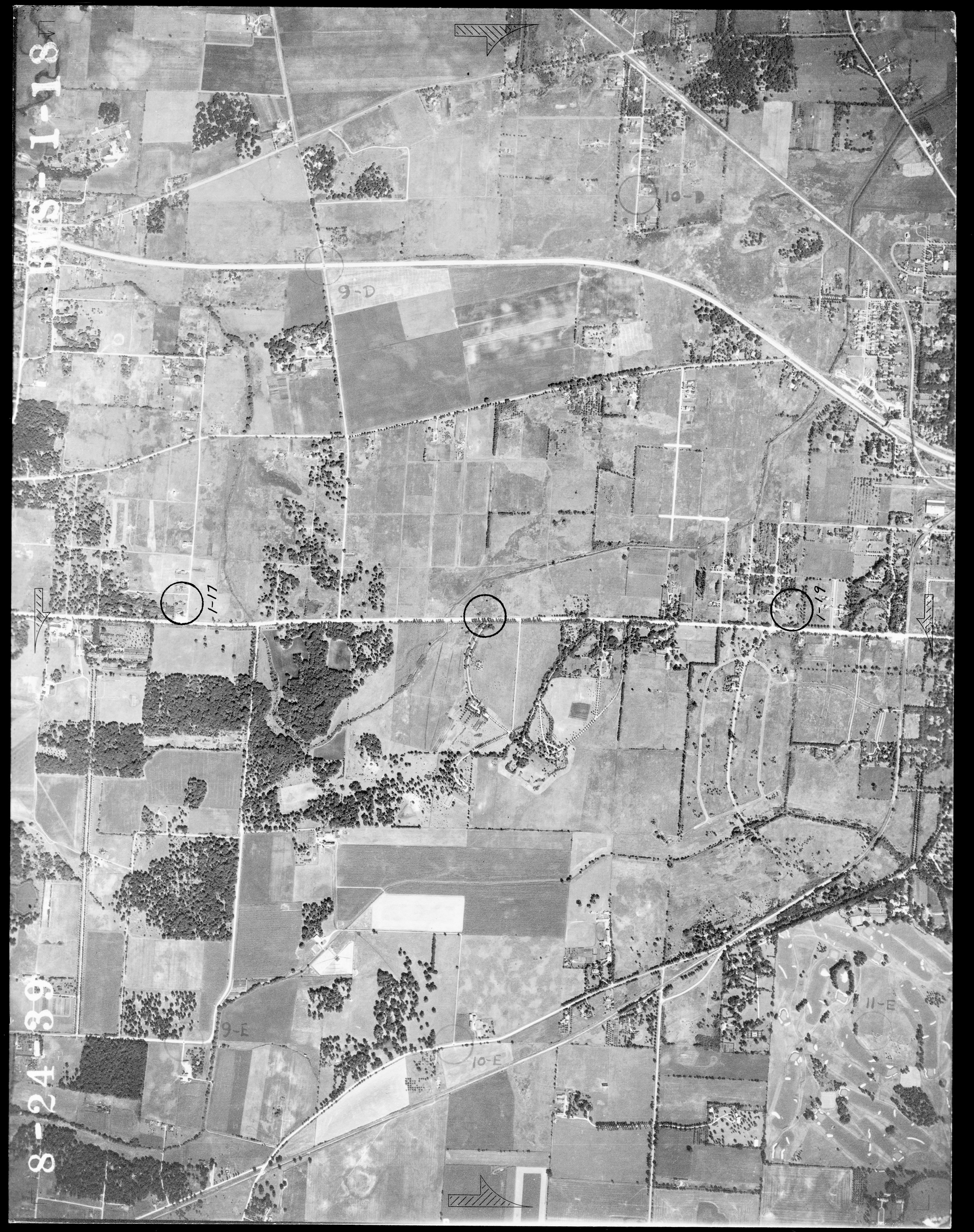
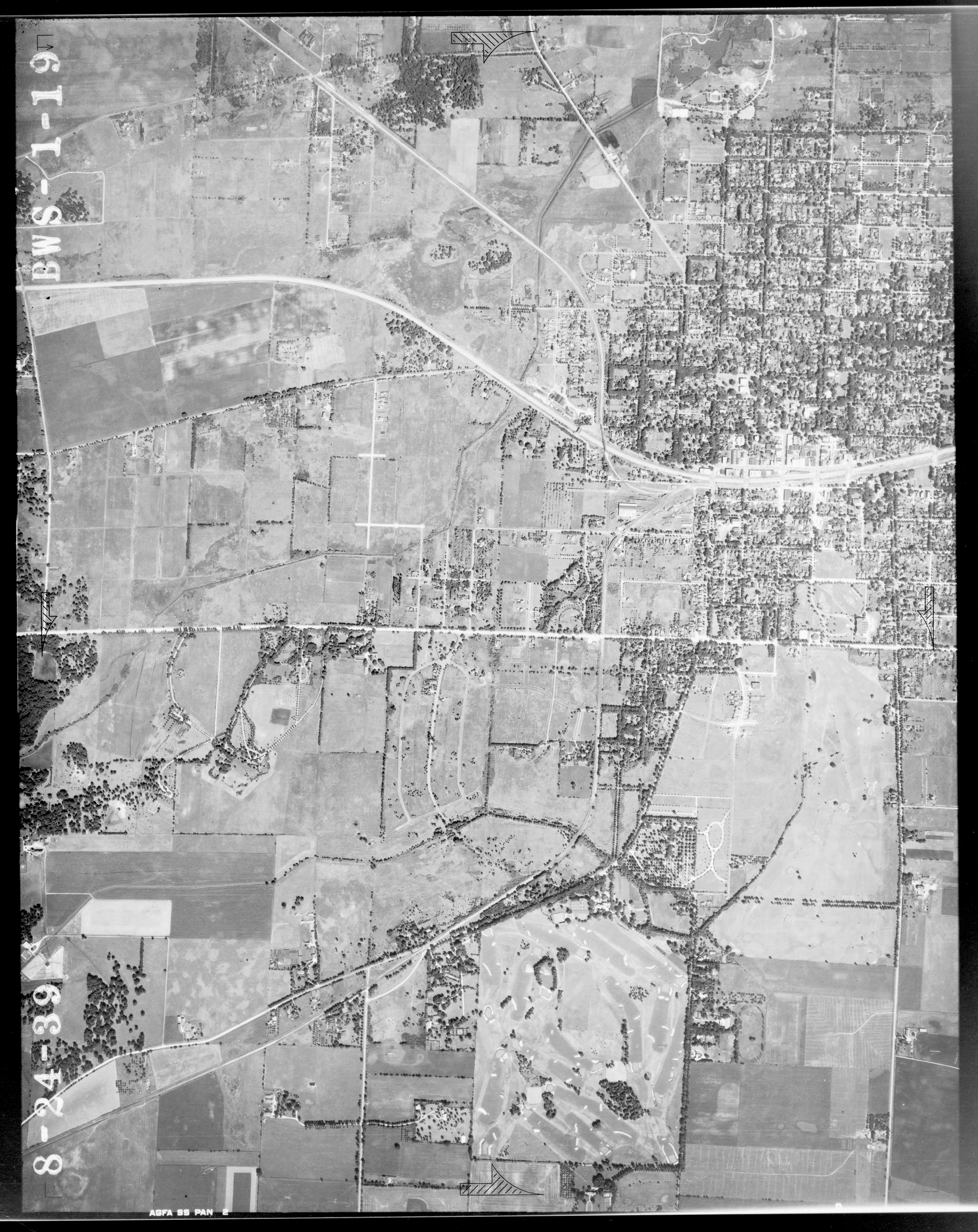
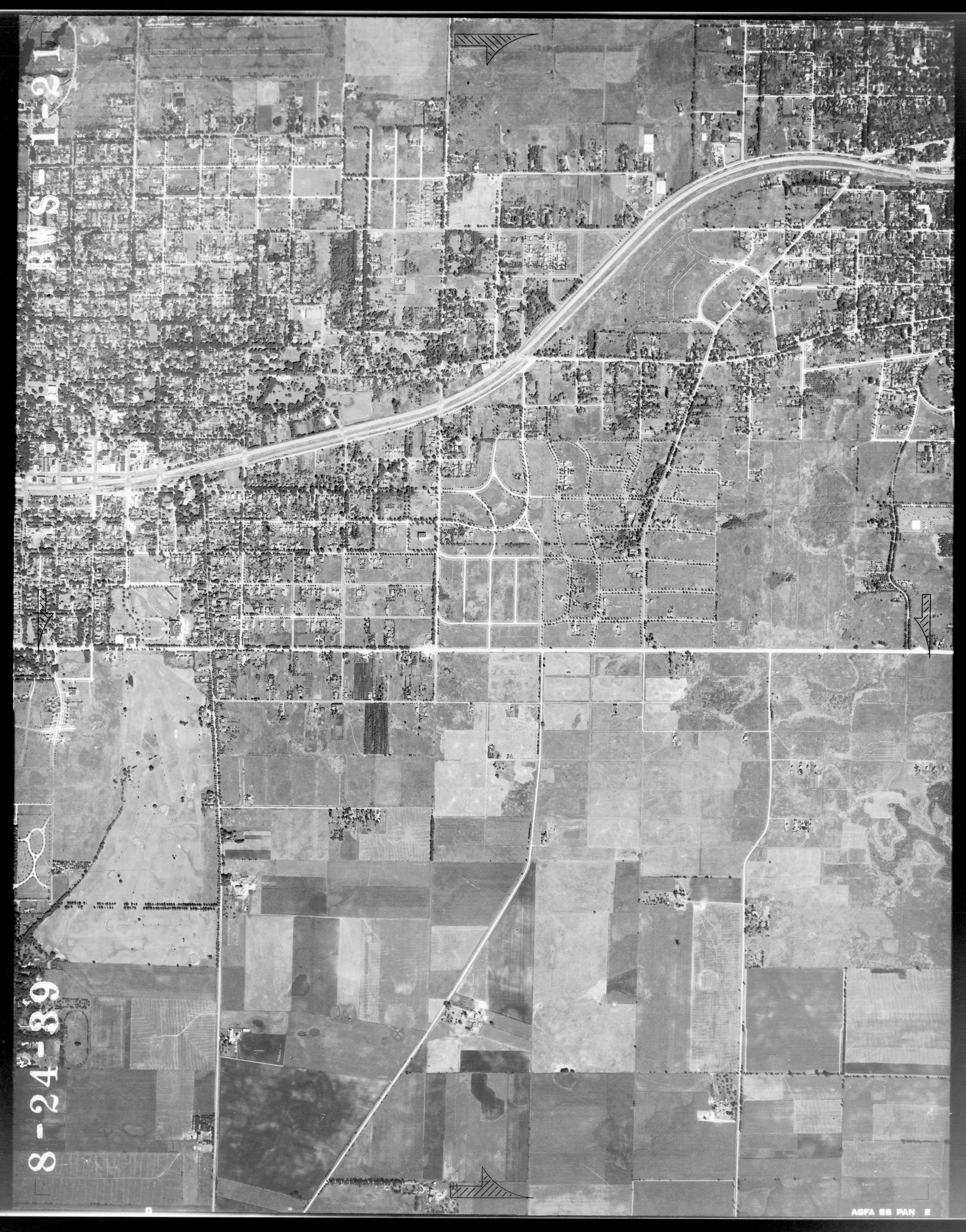
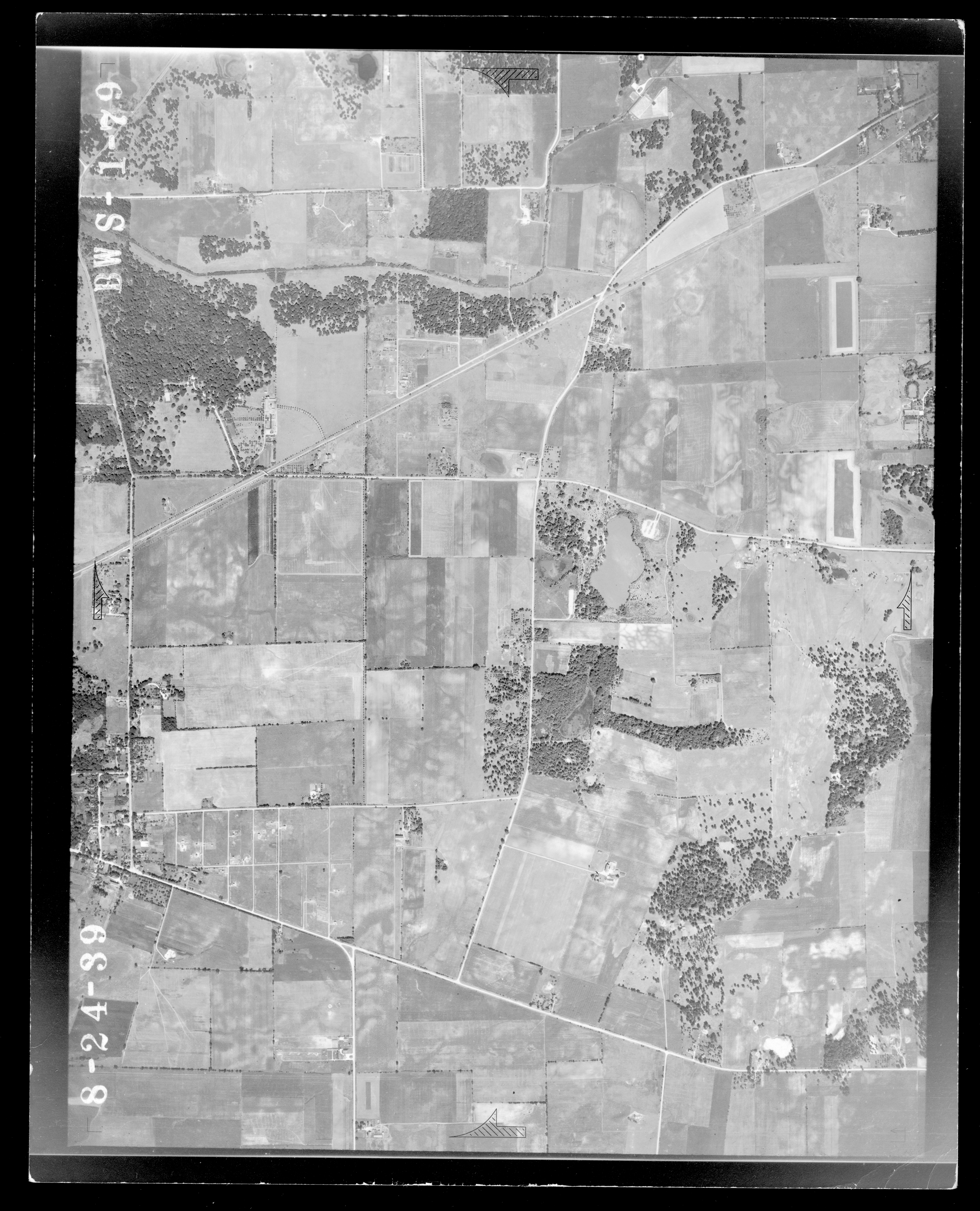
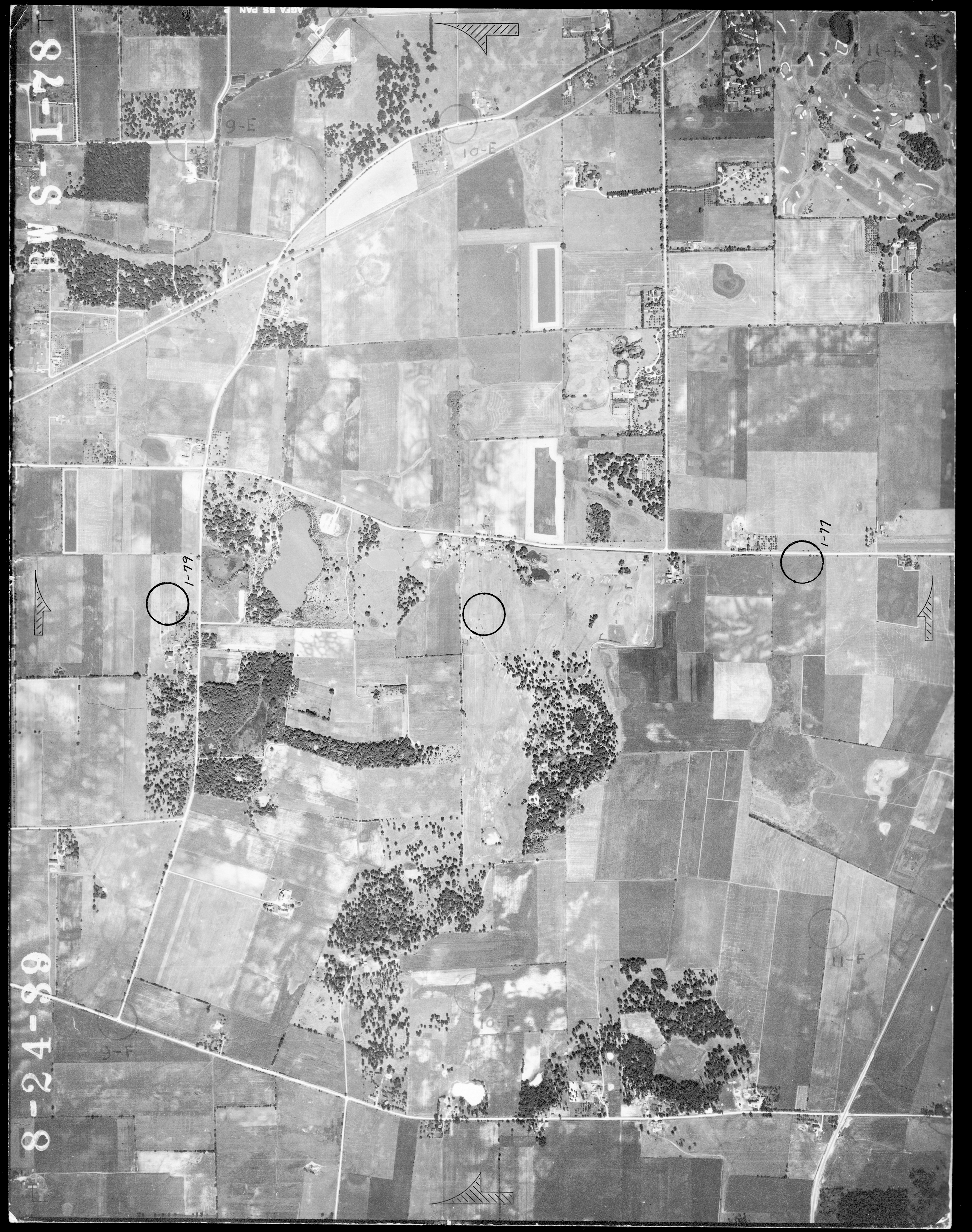
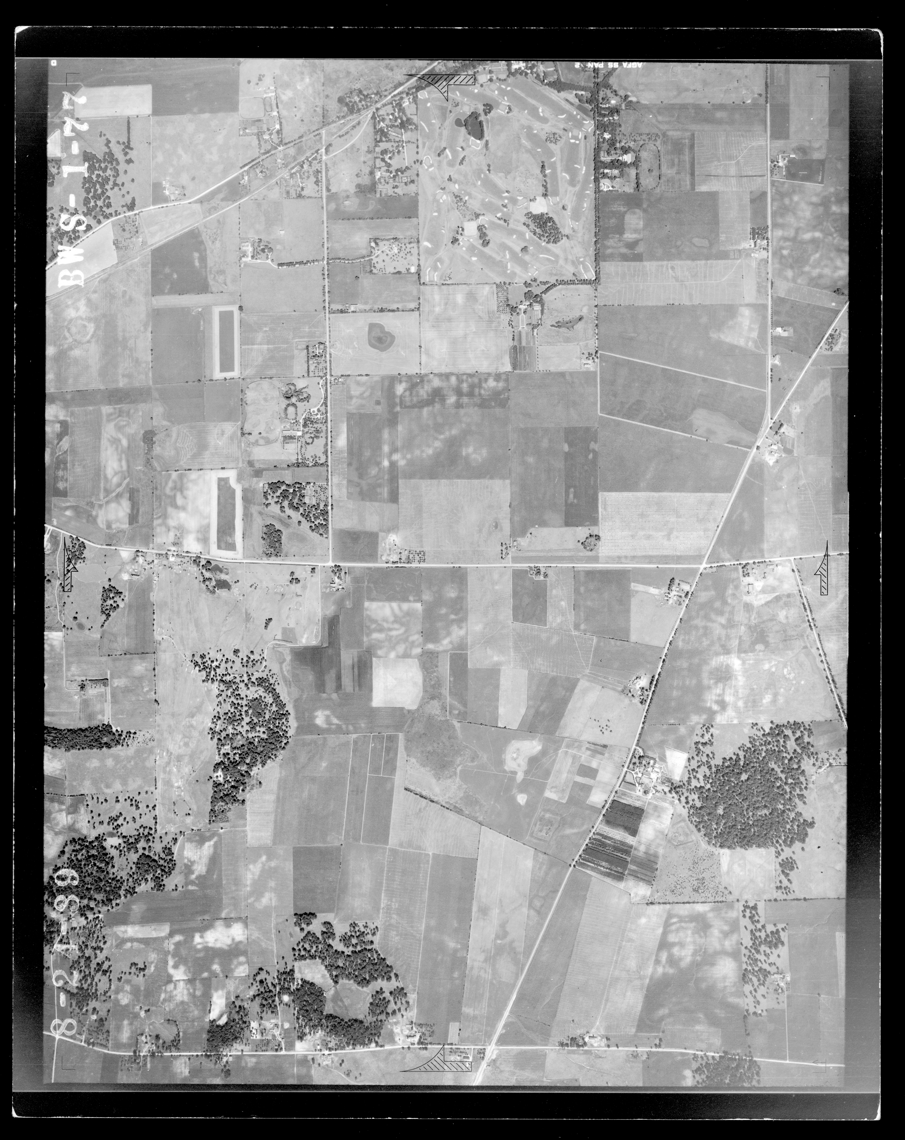
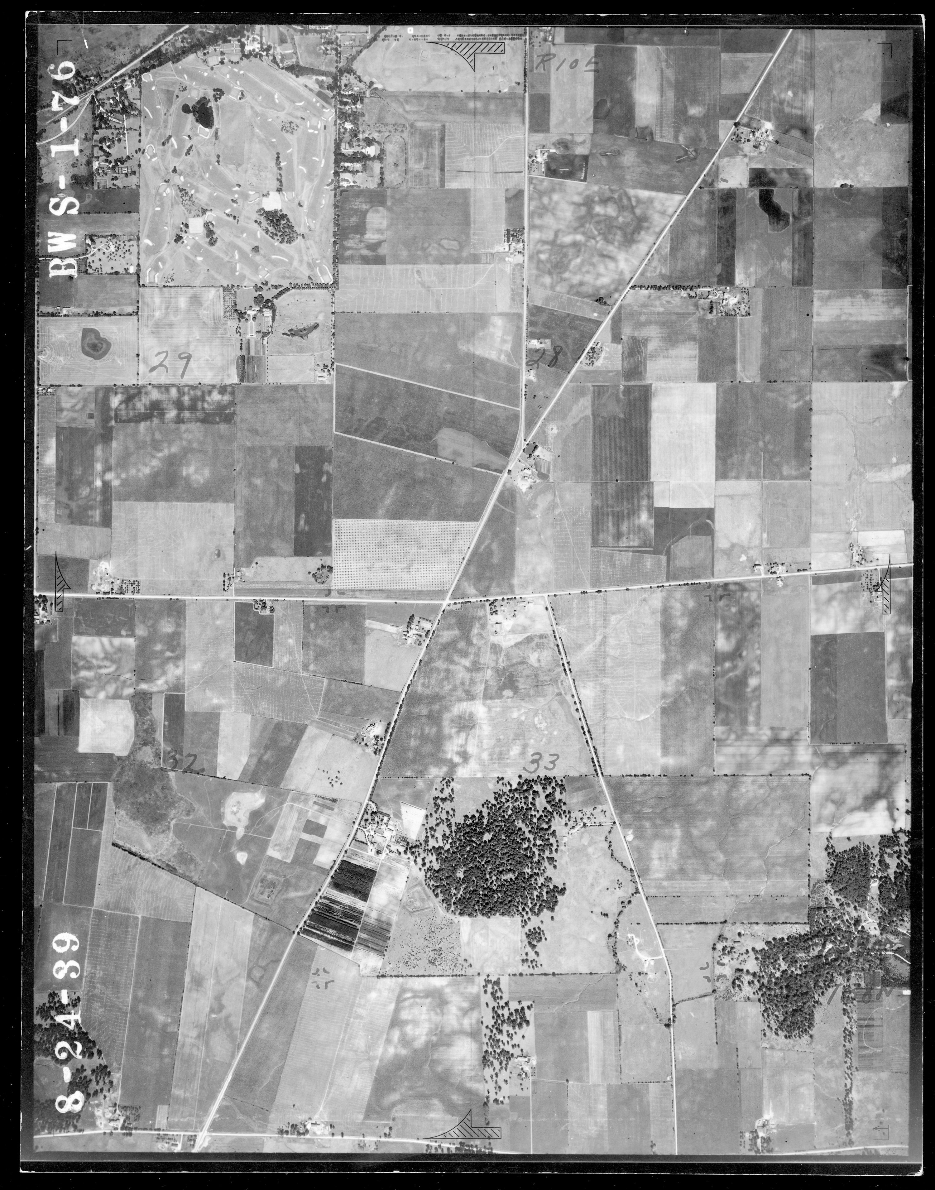
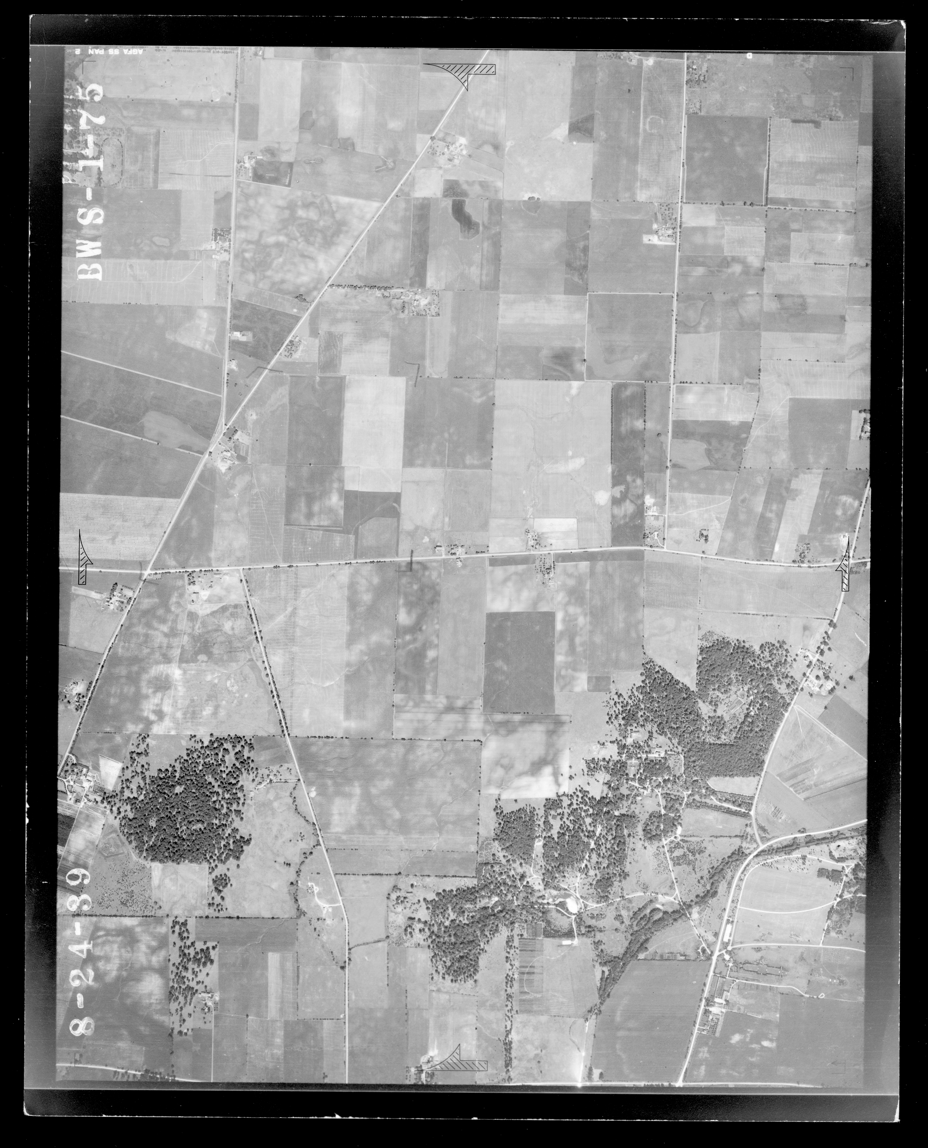
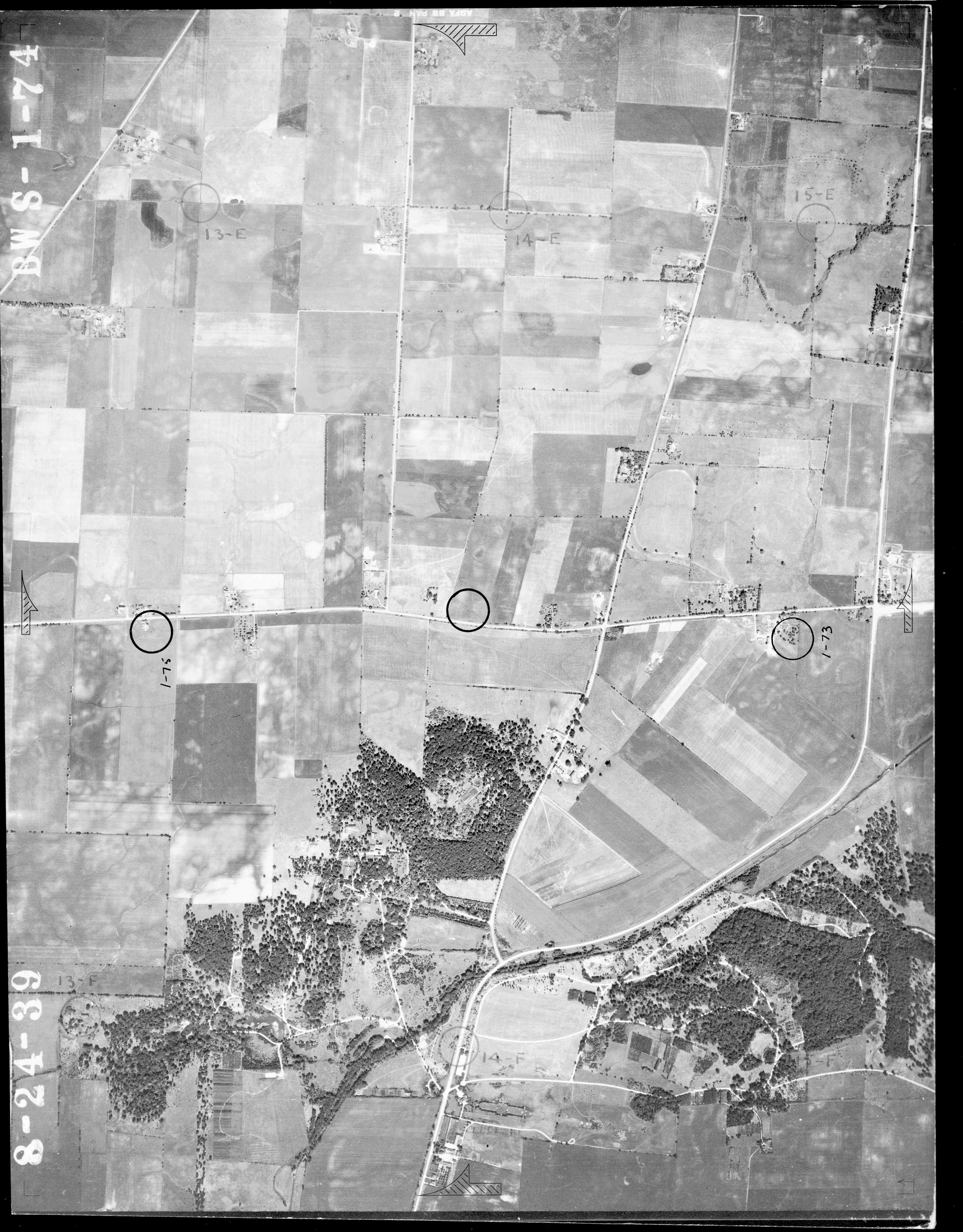
The following aerial photographs were originally used by the United States Department of Agriculture, Agricultural Adjustment Administration (USDA-AAA) to assess the nation's agricultural lands. They are widely recognized as a unique and detailed record of the cultural and physical landscape of Illinois. Statewide coverage of the USDA-AAA aerial photographs was undertaken for Illinois from 1936 through 1941. The photographs of Wheaton were taken on August 24, 1939.
The individual aerial photographs have not been georeferenced meaning there is no locational information on the photographs and no map coordinates are contained within the photographic image file. The links to the photographs below represent an aerial view of Wheaton in 1939 along Geneva, Roosevelt and Butterfield Roads. Each photograph is identified by an intersection using present day roads at approximately the photograph’s center. The additional descriptive information (e.g. BWS 1-17) identifies a particular ‘Photo Center’ found on the map at 1937-1947 Illinois Historical Aerial Photography under the ‘Viewer’ tab. (Description taken in part from http://clearinghouse.isgs.illinois.edu.)
The photographs below are used with permission by the Illinois State Geological Survey. © 2004–2011 University of Illinois Board of Trustees. All rights reserved.
Geneva and County Farm Roads (BWS 1-52)
Geneva and Pleasant Hill Roads (BWS 1-51)
Geneva Road and Gary Avenue (BWS 1-50)
Geneva Road and Main (Schmale) Street (BWS 1-49)
Geneva Road and N. President Street (BWS 1-48)
W. Roosevelt and Shaffner Roads (BWS 1-17)
W. Roosevelt Road and Hazelton Avenue (BWS 1-18)
W. Roosevelt Road and Gables Boulevard (BWS 1-19)
W. Roosevelt Road and Main Street (BWS 1-20)
E. Roosevelt Road and Blanchard St. (BWS 1-21)
Butterfield and Wiesbrook Roads (BWS 1-79)
Butterfield Road and Arrowhead Golf Course (BWS 1-78)
Butterfield and Orchard Roads (BSW 1-77)
Butterfield and Naperville Roads (BWS 1-76)
Butterfield Road and Hull Drive (BWS 1-75)
Butterfield and Lambert Roads (BWS 1-74)
The following print maps are available in the map case in the Genealogy Center on the 2nd floor of the library. Ask at the Adult Services Desk for assistance.
Map of DuPage County 1862
Atlas Map of DuPage County Illinois, 1874
Atlas of Illinois 1876
Map of DuPage County, Illinois 1897
Atlas of DuPage County, Illinois 1904
Farm Plat Book and Business Guide, DuPage County, Illinois 1951
Kane-DuPage Counties Official Farm Plat Book and Directory (ca. 1970)
DuPage County Atlas and Plat Book 1979
DuPage County Land Atlas and Plat Book 1987
Tax Maps of DuPage County, Illinois 2002
Tax Maps of DuPage County, Illinois 2003
Existing and Proposed Bikeways in DuPage County, Illinois 2008
Databases
AtoZ Maps

Explore 145,000 maps of the world, continents, countries, and states. Browse antique and historical maps, climate and ecology maps, flags of the world, and glossaries. Play geography games.
Sanborn Maps of Illinois

Fire insurance maps from 1867-1970 chart the growth and development of towns and cities in Illinois. They are large scale plans of a city or town drawn at a scale of 50 feet to an inch.